- Home Page /
- Books /
- Travel Books, Maps & Guides /
- Shop Travel Books, Maps & Guides by Brand /
- Rand McNally Travel Books, Maps & Guides /
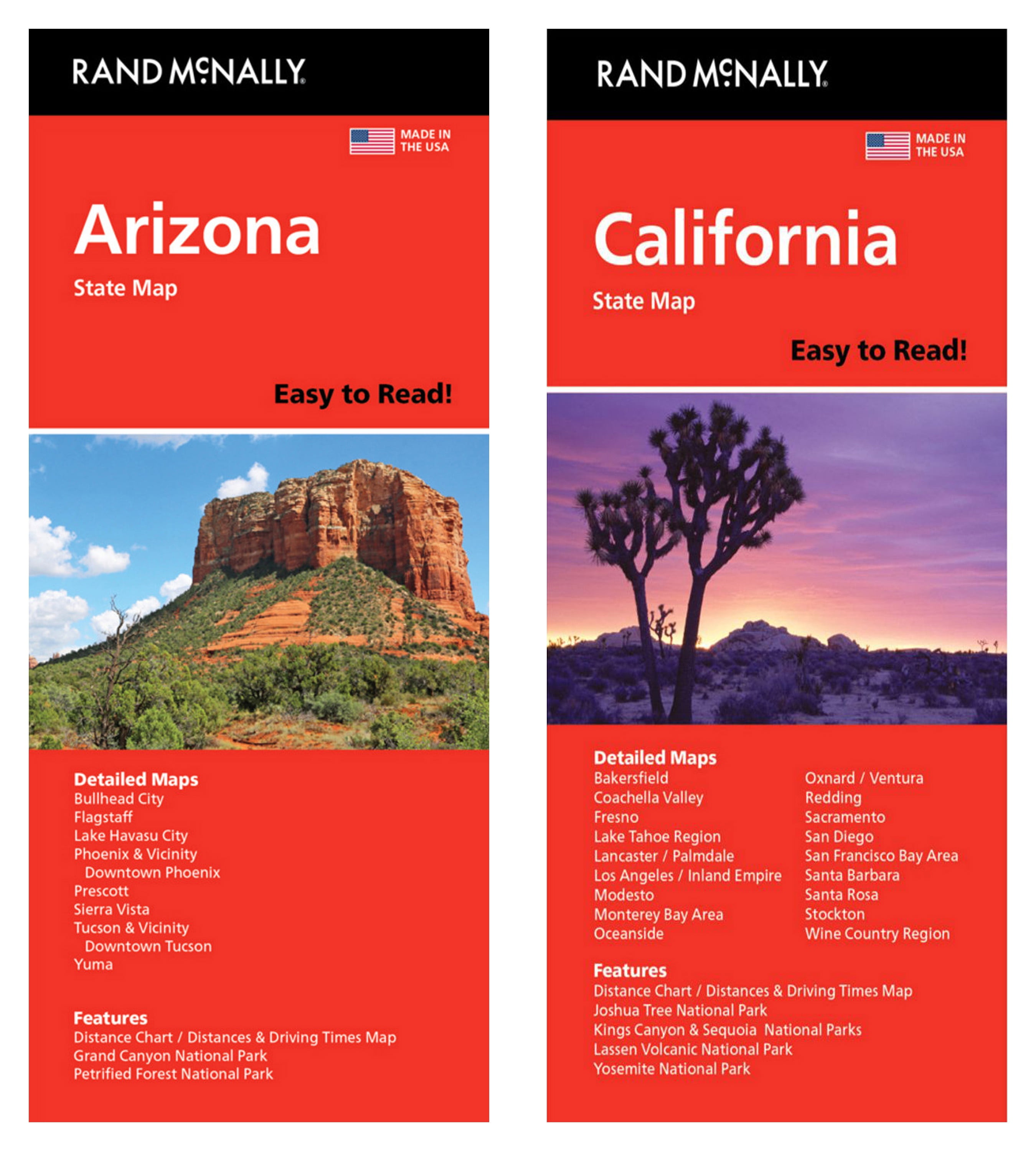
- Rand McNally State Maps: Arizona and Californ...
0 ratings

Item #:
205741759
Rand McNally State Maps: Arizona and California 2 Maps
Item #:
205741759
BDT 4933
Price Details
Excluding Shipping & Custom charges ( Shipping and custom charges will be calculated on checkout )
*All items will import from US
0 ratings
Write a review
In stock
QTY:
Order now and get it around Friday, July 03
Secured transaction
Ubuy works hard to protect your security and privacy. Our advanced payment security system ensures confidentiality by encrypting your information during transmission using AES (Advanced Encryption Standards) and SSL (Secure Socket Layer) protocols. Your payment details are 100% secure as we do not share your payment details with third party sellers.
Our Top Logistics Partners
Rand McNally's Easy To Read State Folded Maps are a must-have for anyone traveling in and around these states, offering unbeatable accuracy and reliability at a great price.
Fast
Shipping
Free
Return*
Secure Packaging
100% Original Products
PCI DSS Compliance

ISO 27001 Certified
Note: Step Down Voltage Transformer required for using electronics products of US store (110-120). Recommended power converters Buy Now.


What Stands Out
Detailed Cartography
Experience accurate and comprehensive state maps, showcasing highways, landmarks, and scenic routes for travelers seeking to explore Arizona and California thoroughly.
Durable Material
Crafted from high-quality materials, these maps withstand wear and tear, making them perfect for road trips and outdoor adventures without worrying about damage.
User-Friendly Design
Designed for easy navigation, foldable formats fit perfectly in pockets or glove compartments, ensuring convenient access while on the go for any traveler.
Product Details
| Map type | Road Maps |
| Features | Foldable |
| Brand | Rand McNally |
| Book format | Paperback |
| Activity | Travel |
| Age group | Adult |
| Item Weight | 0.3 lbs (140 grams) |
Who Should Buy?

-
Travel Enthusiasts
Ideal for travelers looking for detailed maps to explore Arizona and California's attractions and routes.
-
Road Trip Planners
Useful for individuals planning road trips who need reliable navigational tools for both states.
-
Educational Use
Great for students and educators requiring accurate geographical references for projects related to the states.

-
Digital Natives
Not suitable for those who primarily use smartphones and GPS for navigation instead of physical maps.
-
Casual Travelers
May not appeal to casual users who prefer simplified navigation without detailed topographical information.
-
Urban Commuters
Not ideal for urban dwellers who require city-specific maps or navigation solutions for metropolitan areas.
Product Description
Rand McNally State Maps: Arizona and California 2 Maps
Have any Query? Chat with us
Customer Questions & Answers
-
Question:
Are the maps regularly updated?
Answer: Yes, the maps are regularly updated to ensure accuracy. -
Question:
What features are included in the maps?
Answer: The maps include highways, parks, points of interest, airports, county boundaries, and more. -
Question:
How is the map size compared to others?
Answer: The Rand McNally maps are 68% larger than standard folded maps, offering better visibility.
Rand McNally Rand McNally Travel Books, Maps & Guides Editorial Review
No editorial reviews found
Customer Reviews & Ratings
1 customers ratings
-
5 Star
100%
-
4 Star
0%
-
3 Star
0%
-
2 Star
0%
-
1 Star
0%
Review this product
Share your thoughts with other customers
Product Price History
Important information
- Limitations : For products shipped internationally, please note that any manufacturer warranty may not be valid; manufacturer service options may not be available; product manuals, instructions, and safety warnings may not be in destination country languages; the products (and accompanying materials) may not be designed in accordance with destination country standards, specifications, and labeling requirements; and the products may not conform to destination country voltage and other electrical standards (requiring use of an adapter or converter if appropriate). The recipient is responsible for assuring that the product can be lawfully imported to the destination country. When ordering from Ubuy or its affiliates, the recipient is the importer of record and must comply with all laws and regulations of the destination country.
- Not all the products listed on Ubuy are for sale, as Ubuy is a global search engine. Products are subject to export/trade regulations.
BDT 4933
Order now and get it around Friday, July 03
This item is not restrict in my country.(Please click on above link if this item is not restrict in your country, So our team will review and allow.)
QTY:
Secured transaction
Ubuy works hard to protect your security and privacy. Our advanced payment security system ensures confidentiality by encrypting your information during transmission using AES (Advanced Encryption Standards) and SSL (Secure Socket Layer) protocols. Your payment details are 100% secure as we do not share your payment details with third party sellers.
Our Top Logistics Partners
Fastest cross-border delivery
Features & Benefits
- 68% larger map for better visibility
- Clearly labeled highways and points of interest
- Indications of parks and airports for convenience
- Detailed mileage and driving times for efficient travel
- Easy-to-use legends and detailed indexes for quick navigation
- Trusted standard in cartography for reliable travel planning